
Examples
Great British Food: StoryMap
As part of the Great British Food campaign, Defra used Knight Lab’s free StoryMap tool (https://storymap.knightlab.com/) to build an engaging … Read more » – Great British Food: StoryMap

Are you ‘Open for Business’?
DCLG developed a public mapping tool using ArcGIS to enable users to add their own or local business to a … Read more » – Are you ‘Open for Business’?
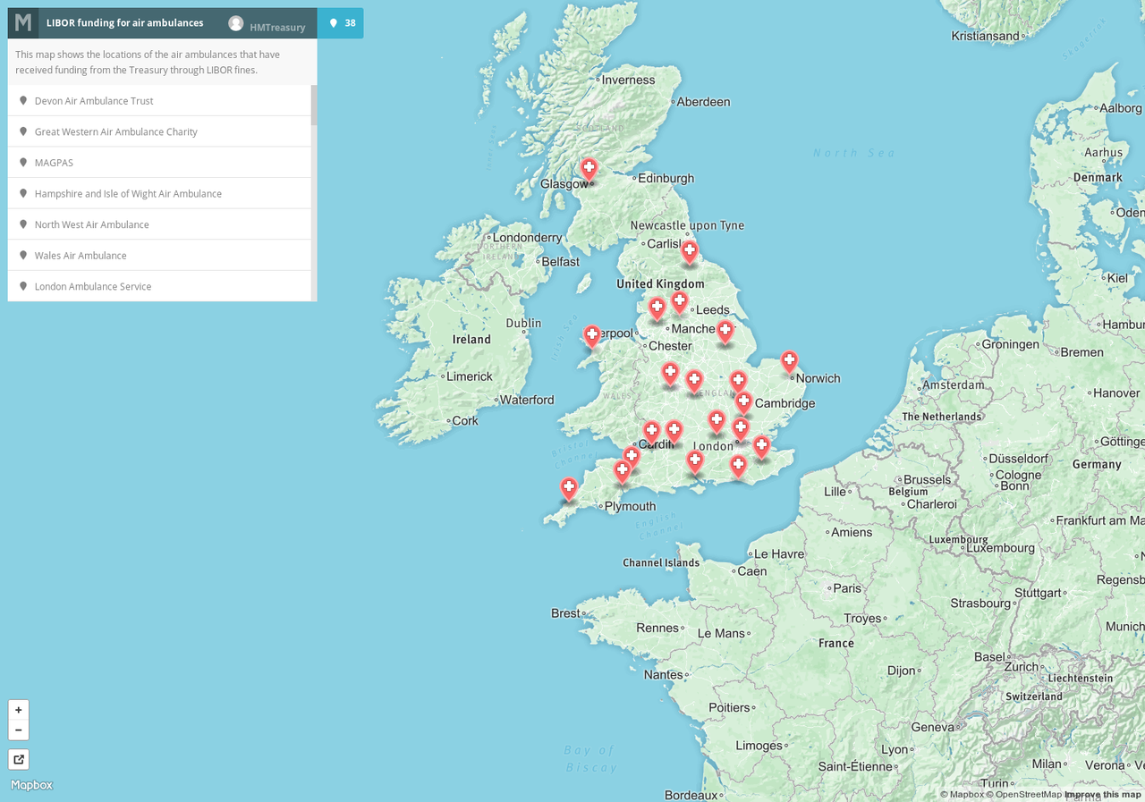
LIBOR funding for air ambulances
Interesting use of Mapbox, a Google Maps-style mapping platform which markets itself primarily at developers, to tell a geographical story … Read more » – LIBOR funding for air ambulances
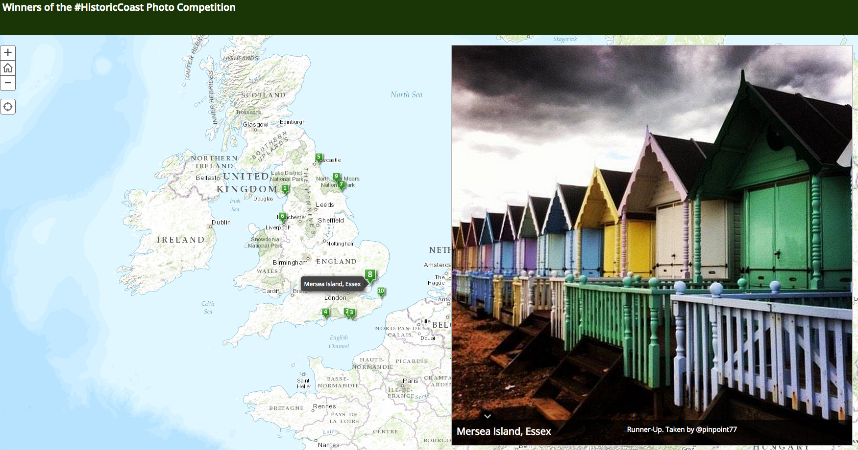
DCLG and English Heritage coastal communities competition
The Department for Communities and Local Government (DCLG) and English Heritage ran a joint competition to find the most popular … Read more » – DCLG and English Heritage coastal communities competition
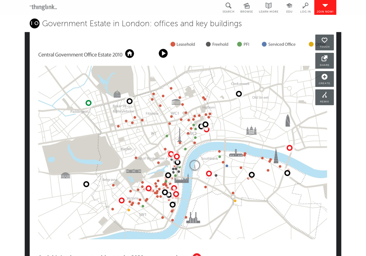
Government Estate in London: offices and key buildings
As part of an impressive digital package around efficiency savings through estates rationalisation, the Cabinet Office used interactive image-making tool … Read more » – Government Estate in London: offices and key buildings
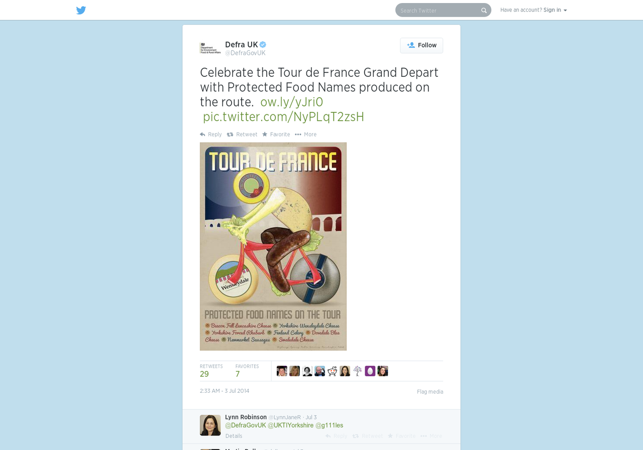
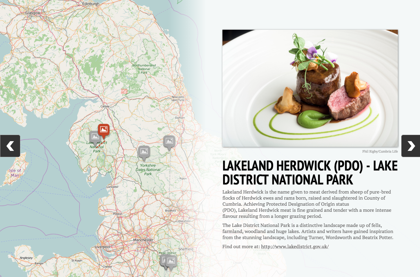
Defra Tour de France infographic on protected food names
A lovely little tactical campaign infographic from Defra, combining their Google Map of protected British food names, with the route … Read more » – Defra Tour de France infographic on protected food names

Rural Roadshows 2014 #RuralRoadshow (with images, tweet) · DefraGovUK · Storify
Defra is using Storify, incorporating tweets, images and a Google map to show how ministers and others are running a … Read more » – Rural Roadshows 2014 #RuralRoadshow (with images, tweet) · DefraGovUK · Storify
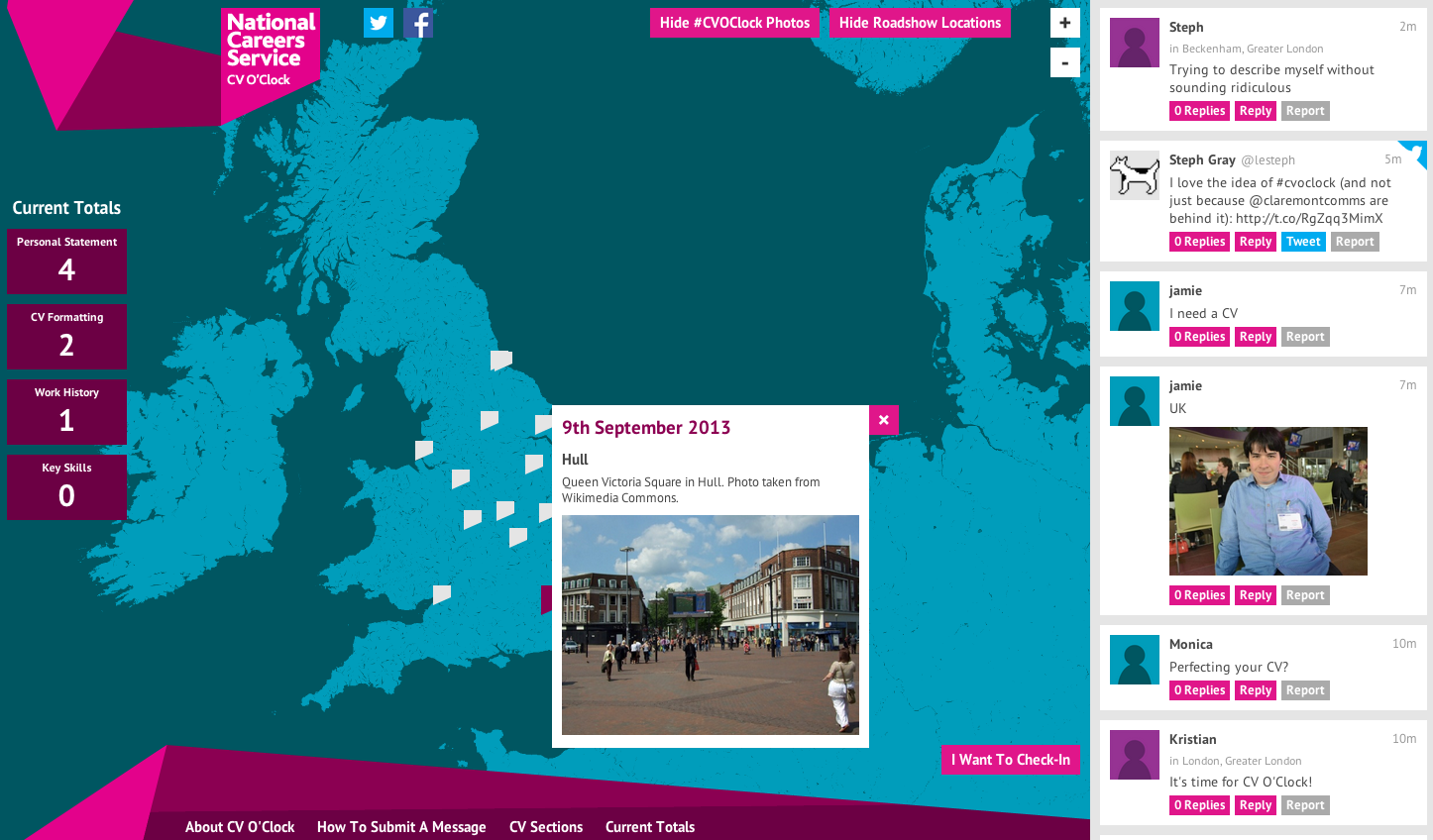
CV O’Clock
A neat campaign microsite from the National Careers Service, for people to work on their CVs together and share their … Read more » – CV O’Clock
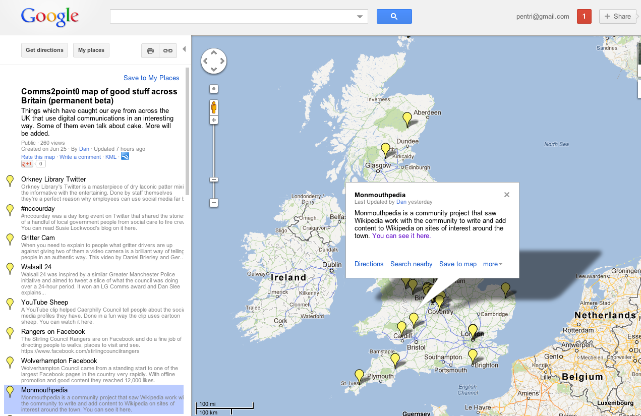
Map of digital innovation across the UK
Dan Slee, a contributor here, has set up a Google map of good examples of creative use of digital and … Read more » – Map of digital innovation across the UK
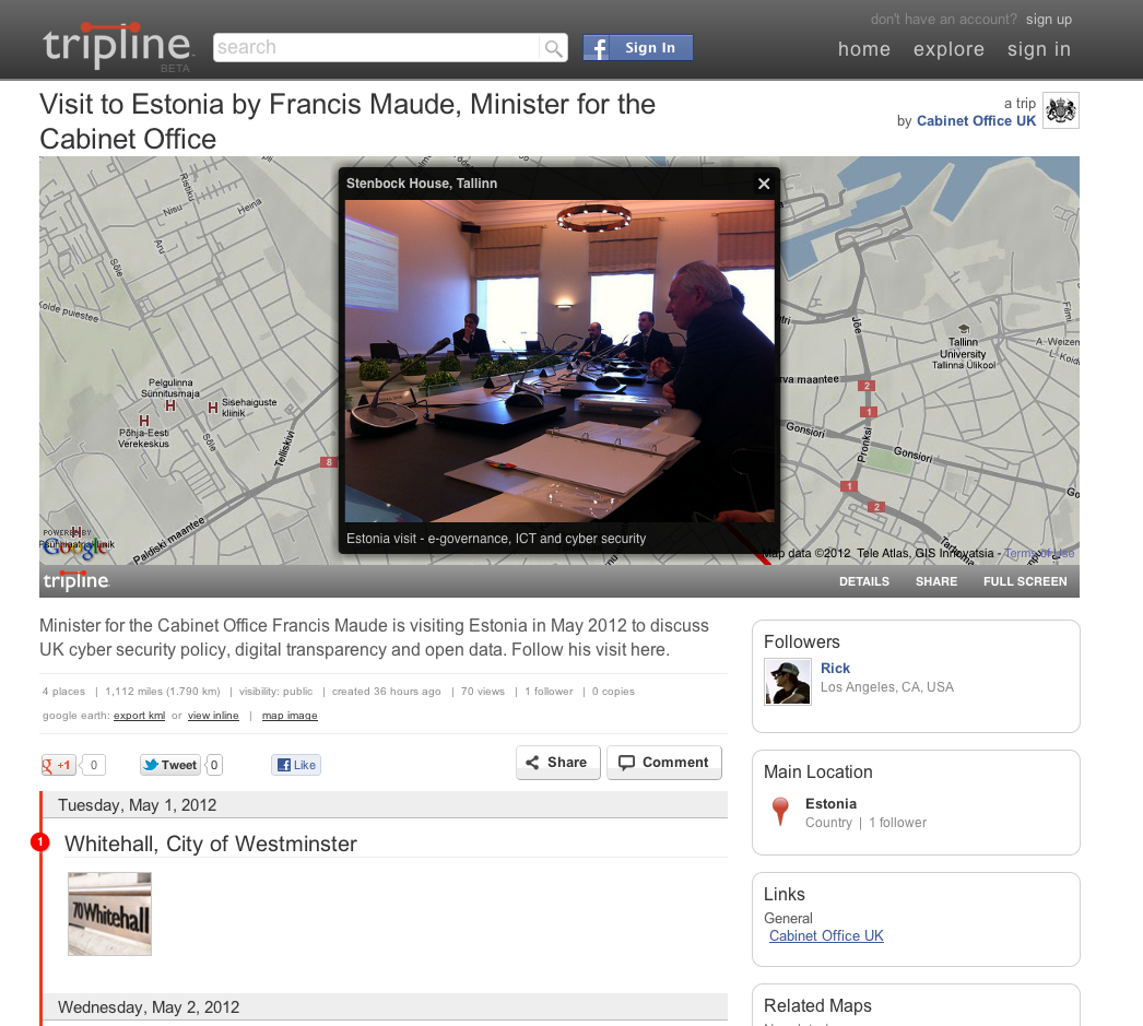
Visit to Estonia by Francis Maude, Minister for the Cabinet Office on Tripline
An interesting and creative use of online timeline creator, Tripline, by the Cabinet Office to cover the trip of minister … Read more » – Visit to Estonia by Francis Maude, Minister for the Cabinet Office on Tripline
 Everything